Harbor Place
The land adjacent to Straight, Old South and Commercial Wharves has long been at the heart of downtown Nantucket. The area has been redeveloped several times over, from whaling and fisheries support to the Hy-Line, high end restaurants and the site of downtown’s grocery store. The recent removal of the tank farms offers a new opportunity to reimagine our interactions with this working waterfront.
Courtesy of the Nantucket Historical Association
Past
-
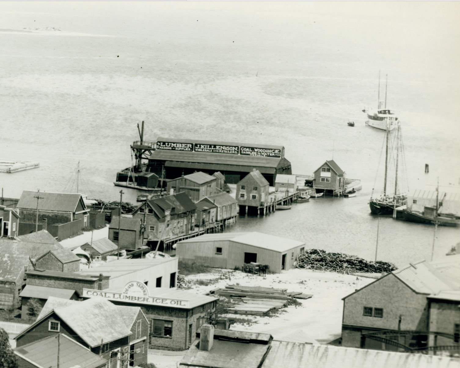
1920s Working Waterfront
Close up view of Straight Wharf from the tower of the Unitarian Church, showing the J. Killen & Son wharf warehouse and Island Service Company. (Courtesy of the Nantucket Historical Association)
-
Working Waterfront
Close up view of Old South Wharf from the Unitarian Church tower. Straight Wharf, with J. Killen & Son Coal Wood Ice is on the left, Old South Wharf, with Island Service Company, is on the right. (Courtesy of the Nantucket Historical Association)
-
Another Call for Resilience
Image of the fire at Zero Main Street, December 18, 1979. Aftermath of the Zero Main Street fire, with firemen still hosing the building. In the background is the Club Car restaurant, untouched by the fire. (Courtesy of the Nantucket Historical Association)
Present
-
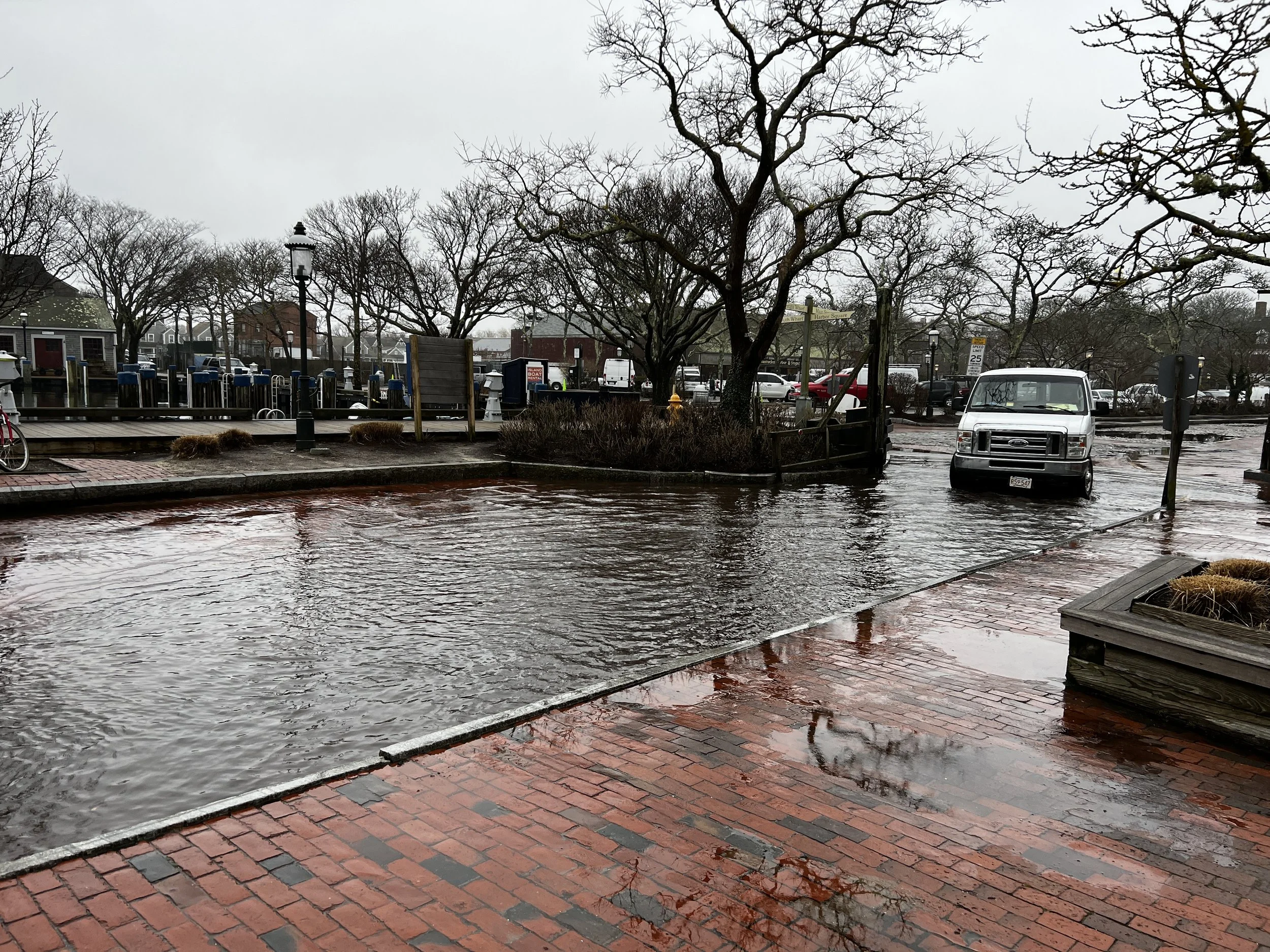
A Difficult Commute
The intersection of Straight Wharf and New Whale experiences frequent flooding, but is the main thoroughfare to and from the Hyline high speed passenger boats. (Will Kinsella photo)
-
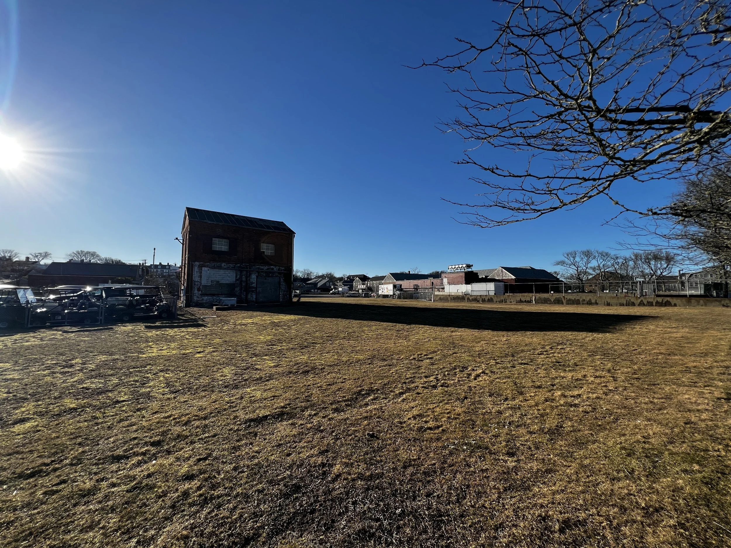
Blank Slate
A large portion of the waterfront has been cleared of old warehouses and the tank farm. Public-private partnership of the Town of Nantucket, National Grid, NE Development and ReMain redevelopment proposals include inter-modal transportation, parking, housing and commercial space. (Will Kinsella photo)
-
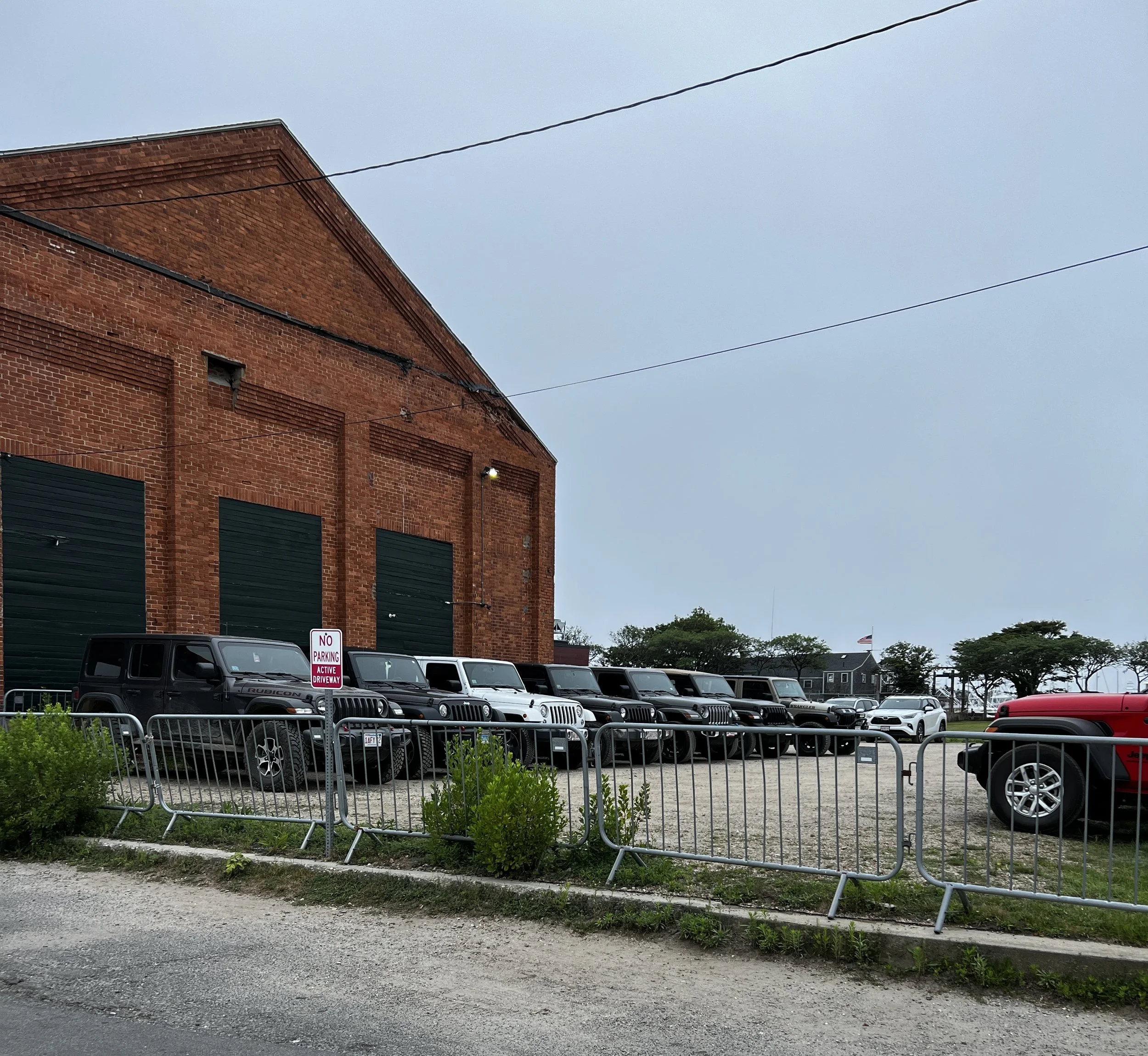
Adaptive Reuse
The Town of Nantucket in partnership National Grid of Massachusetts offers parking in their parking lot located on Candle Street. National Grid has become an invaluable partner in the Town’s struggle to provide a convenient, safe and affordable alternative to traditional downtown parking options on the island. (Photo by Will Kinsella)
-
Ongoing Planning Efforts
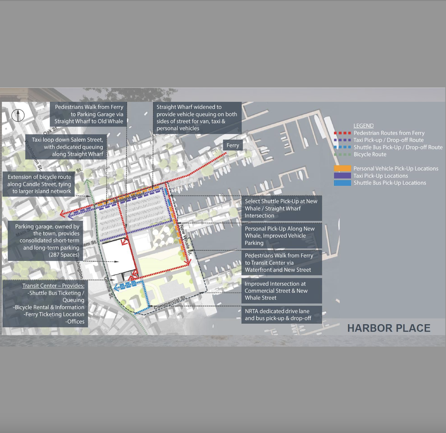
Early in 2020, following a presentation by the Harbor Place property owners representatives, at its January 15, 2020 meeting the Select Board agreed to put forward a request to voters at the 2020 Annual Town Meeting for $150,000 to secure consultants to examine, and help the Town determine the extent and specificity of municipal infrastructure upgrades that will be needed in connection with the development of the property; additionally, the Town may be acquiring property for transportation-related purposes as part of the overall plan. These funds will provide the ability to engage professionals to refine the extent and cost of the infrastructure upgrades as well as the specifics as to the transportation program. Image from the April 24, 2018 Harbor Place Intermodal Center Project Meeting.
Future(s)
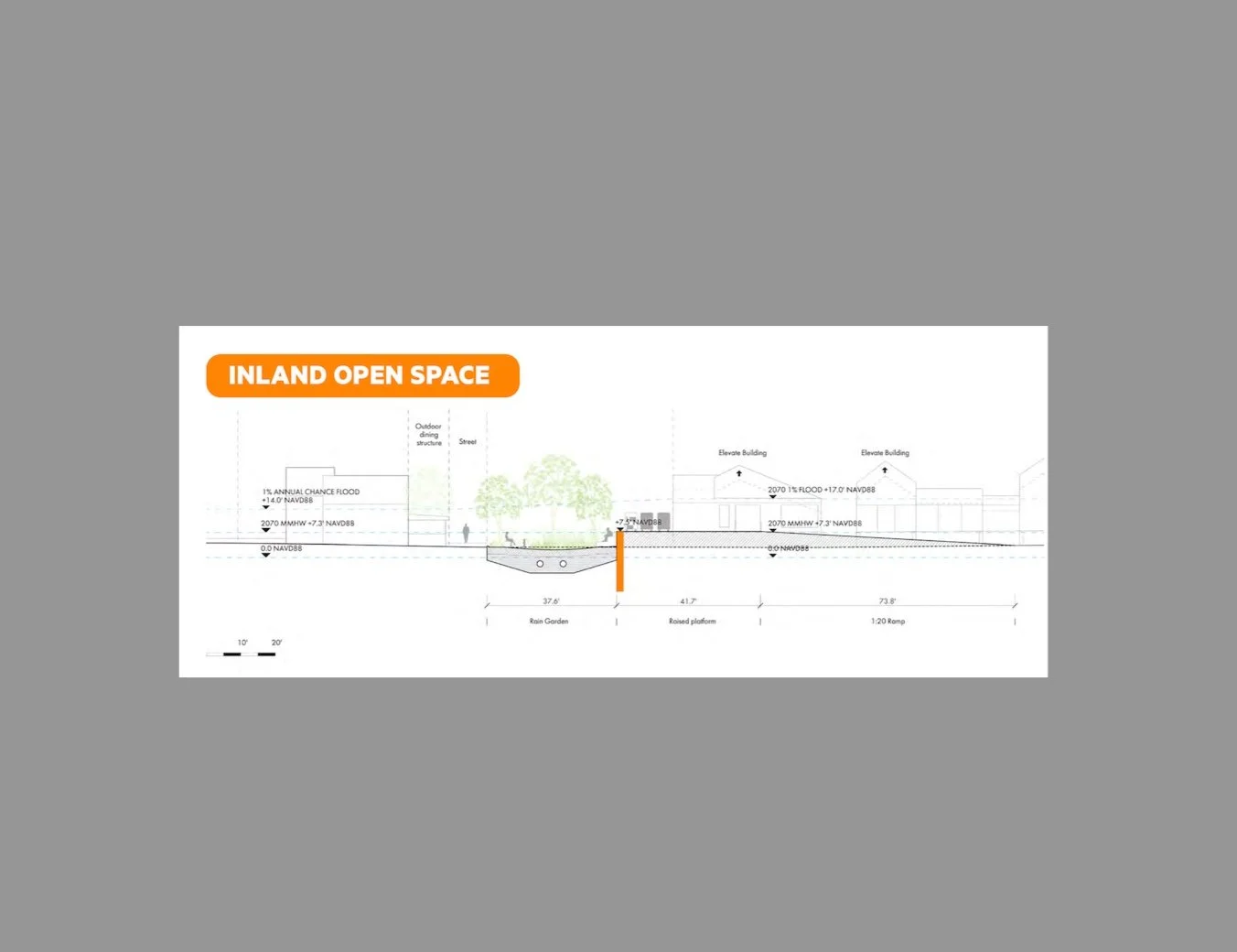
These conceptual renderings are illustrative of potential long-term resilience strategies and do not represent final designs or near-term recommendations. These are presented to help inform community discussions about long-term adaptation.
The future remains up to us.
-
Collaborative Solutions
The Coastal Resilience Plan includes a number of recommended strategies to reduce flood risk. Collaboration with private and public property owners and other stakeholders is necessary to implement various approaches. (CRP p. 149)
-
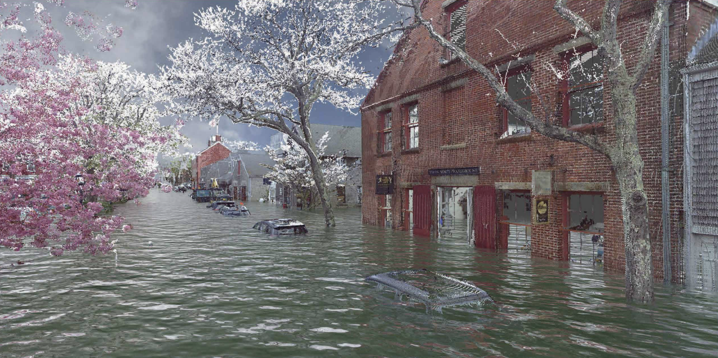
2080 6.14' sea level rise projections
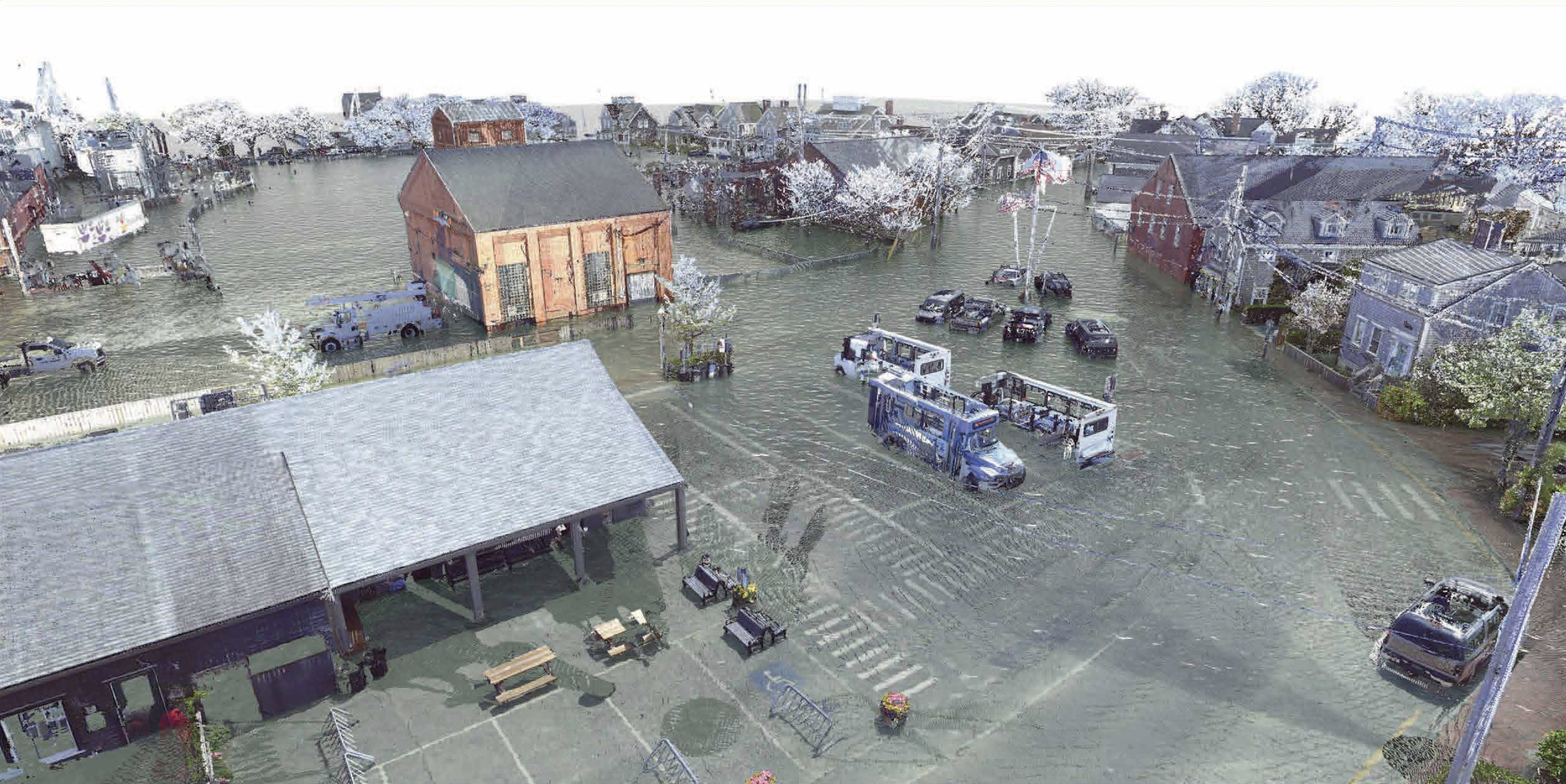
2019 NOAA Intermediate-High scenarios predicted 6.14' sea level rise projections (above NAVD88) for the year 2060. Using LIDAR 3D scanners and NOAA flood projections, the University of Florida's Preservation Institute Nantucket has been able to provide visualizations of sea level rise projections against precise building elevation measurements. (Image Courtesy of University of Florida Preservation Institute Nantucket)
-
2100 8.04' sea level rise projections
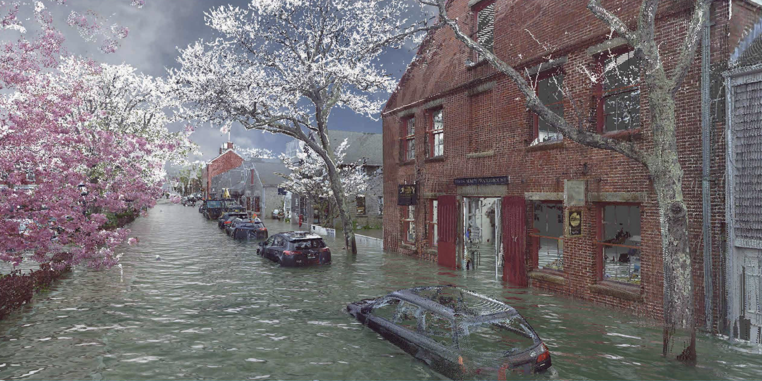
2019 NOAA Intermediate-High scenarios predicted 8.04' sea level rise projections (above NAVD88) for the year 2100. Using LIDAR 3D scanners and NOAA flood projections, the University of Florida's Preservation Institute Nantucket has been able to provide visualizations of sea level rise projections against precise building elevation measurements. (Image Courtesy of University of Florida Preservation Institute Nantucket)
-
LIDAR 3D Recreation
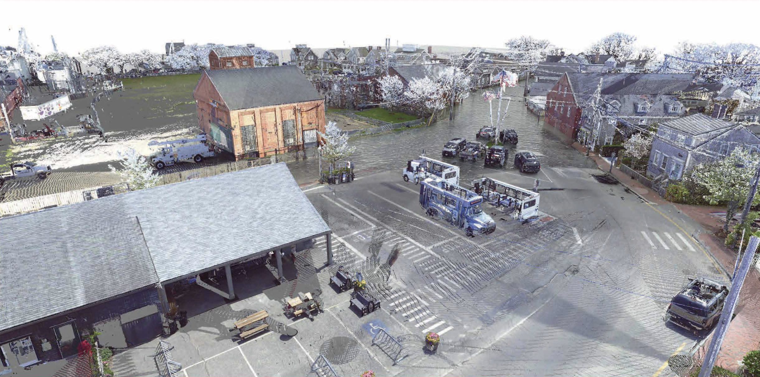
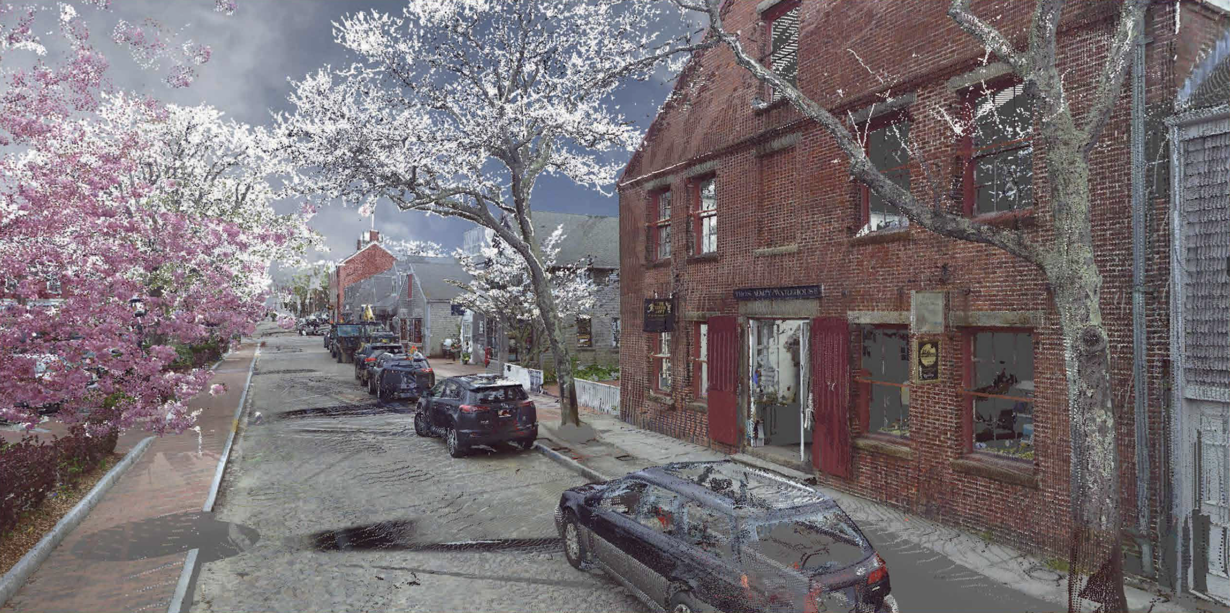
2019 conditions. Using LIDAR 3D scanners and NOAA flood projections, the University of Florida's Preservation Institute Nantucket has been able to provide visualizations of sea level rise projections against precise building elevation measurements. (Image Courtesy of University of Florida Preservation Institute Nantucket)
-
2060 4.54' sea level rise projections
2019 NOAA Intermediate-High scenarios predicted 4.54' sea level rise projections (above NAVD88) for the year 2060. Using LIDAR 3D scanners and NOAA flood projections, the University of Florida's Preservation Institute Nantucket has been able to provide visualizations of sea level rise projections against precise building elevation measurements. (Image Courtesy of University of Florida Preservation Institute Nantucket)
-
2080 6.14' sea level rise projections
2019 NOAA Intermediate-High scenarios predicted 6.14' sea level rise projections (above NAVD88) for the year 2080. Using LIDAR 3D scanners and NOAA flood projections, the University of Florida's Preservation Institute Nantucket has been able to provide visualizations of sea level rise projections against precise building elevation measurements. (Image Courtesy of University of Florida Preservation Institute Nantucket)
-
2100 8.04' sea level rise projections
2019 NOAA Intermediate-High scenarios predicted 8.04' sea level rise projections (above NAVD88) for the year 2100. Using LIDAR 3D scanners and NOAA flood projections, the University of Florida's Preservation Institute Nantucket has been able to provide visualizations of sea level rise projections against precise building elevation measurements. (Image Courtesy of University of Florida Preservation Institute Nantucket)
-
Envision Resilience Projects
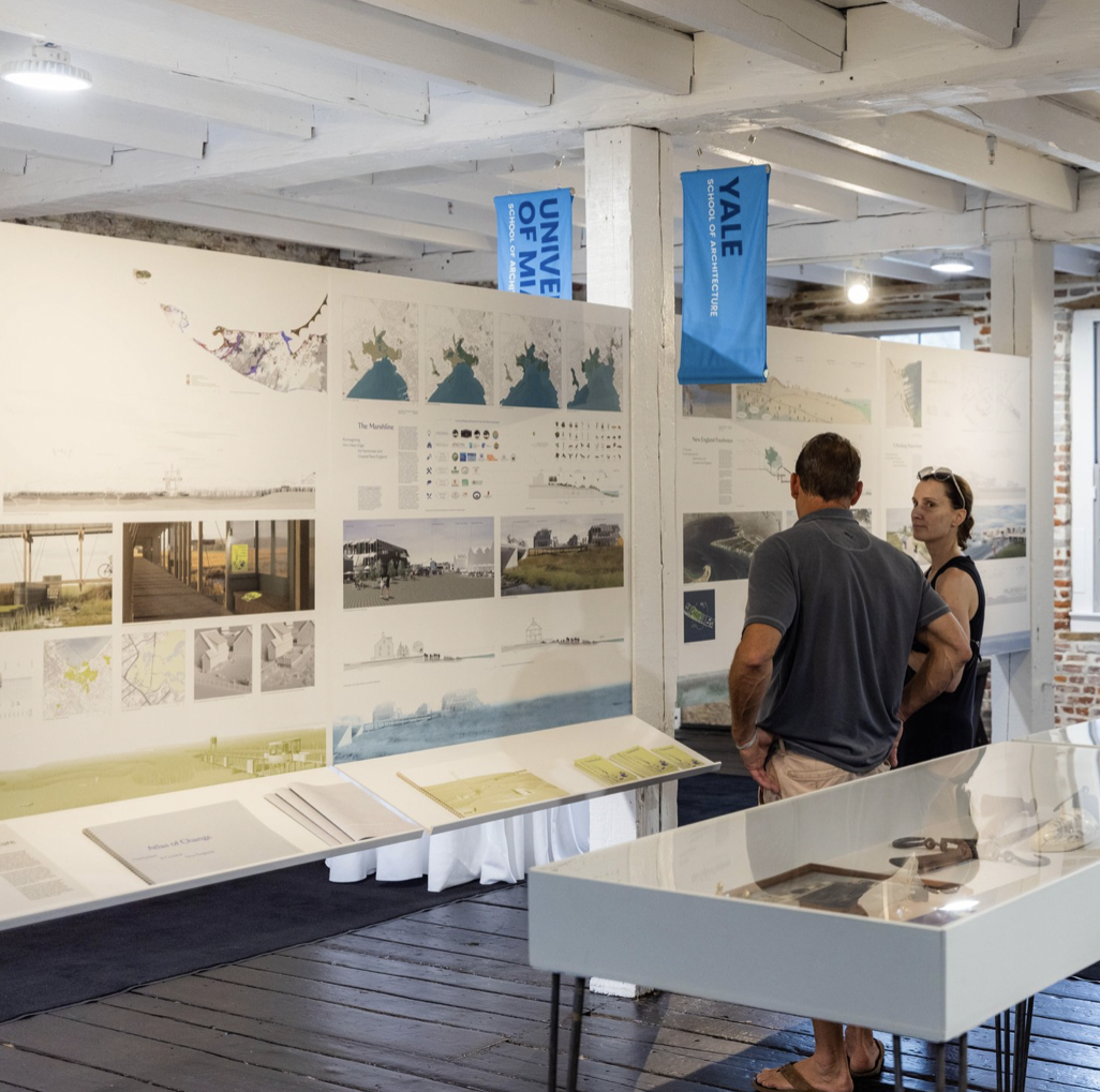
In the Spring of 2021 ReMain Nantucket convened a group of more than 20 local and regional advisors to bring expertise in conservation, public works, real estate, architecture, historic preservation, natural resources, marine biology, fisheries, civil engineering, art, science, and transportation to participating university teams. This interdisciplinary group provided resources and insight as the teams moved through the spring 2021 semester and examined the complex issue of sea level rise on Nantucket. During the 2021 Envision Resilience Nantucket Challenge, the student teams were untethered to local zoning, policy and permitting regulations and encouraged to design big and bold, as you will see in their visionary, out-of-the-box ideas. Though the designs may be far from shovel-ready, they created the space for our community to engage in more positive, hopeful and meaningful conversations about our future. (Photo Courtesy of Envision Resilience)
-
Thinking Outside the Box
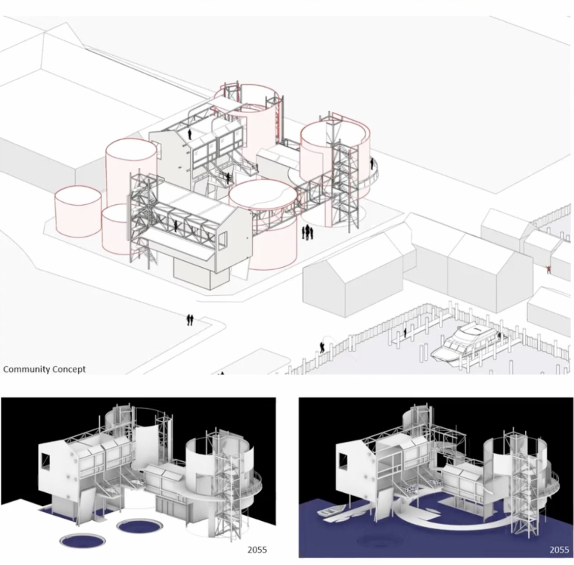
ReMain's 20221 Envision Resilience challenge gathered students from 5 universities to reimagine Nantucket's harbor for sea level rise. An example of "Dwelling on the Edge" by the University of Florida: Experimenting with new and unique programs and opportunities for dwelling and space making beyond traditional means of construction. While more formal development proposals like Harbor Place provide more of the same architectural character and aesthetic that Nantucket is known for, the [since removed] tanks provide ample opportunity for provocative and intriguing design that celebrates the past while planning for a resilient future. (Image Courtesy of Envision Resilience)
-
Innovative Adaptations
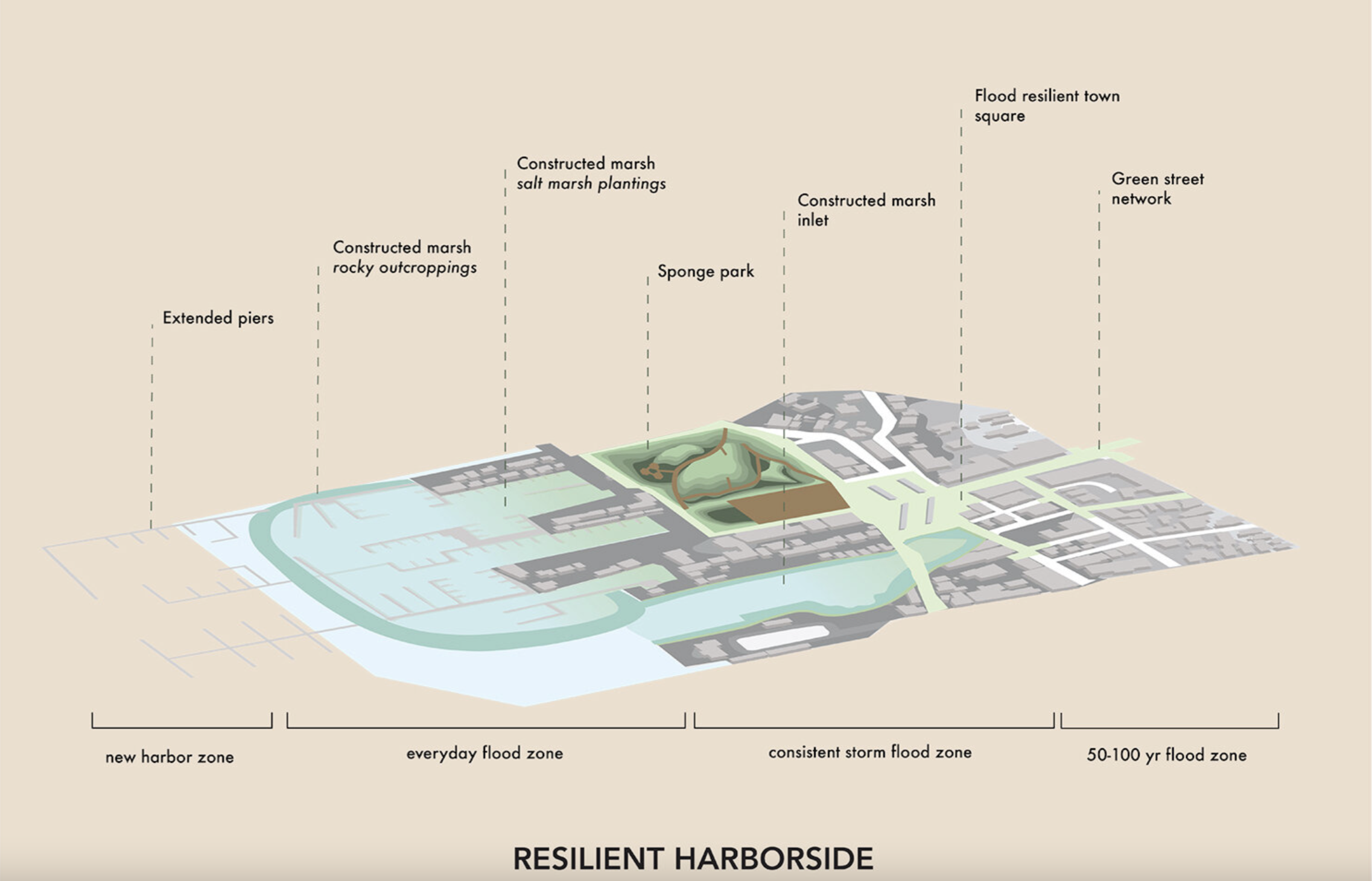
ReMain's 2021 Envision Resilience challenge gathered students from 5 universities to reimagine Nantucket's harbor for sea level rise. An example of “Transitional Ecologies: New Public Infrastructures for Nantucket” by Northeastern University. (Courtesy of Envision Resilience)
-
Harbor Place Intermodal Center Project Meetings
Early in 2020, following a presentation by the Harbor Place property owners representatives, at its January 15, 2020 meeting the Select Board agreed to put forward a request to voters at the 2020 Annual Town Meeting for $150,000 to secure consultants to examine, and help the Town determine the extent and specificity of municipal infrastructure upgrades that will be needed in connection with the development of the property; additionally, the Town may be acquiring property for transportation-related purposes as part of the overall plan. These funds will provide the ability to engage professionals to refine the extent and cost of the infrastructure upgrades as well as the specifics as to the transportation program. (Image Courtesy of the Town of Nantucket)